
Based on its main landmass alone, Kiribati is the only country that stretches across all four hemispheres. However, when considering their territories, the U.S., France and the U.K. also can make this claim.
Kiribati (pronounced Keer-uh-boss) is a country unique for many reasons. It's isolated, it consists of 33 low-lying islands and it holds the biggest water-to-land ratio in the world.
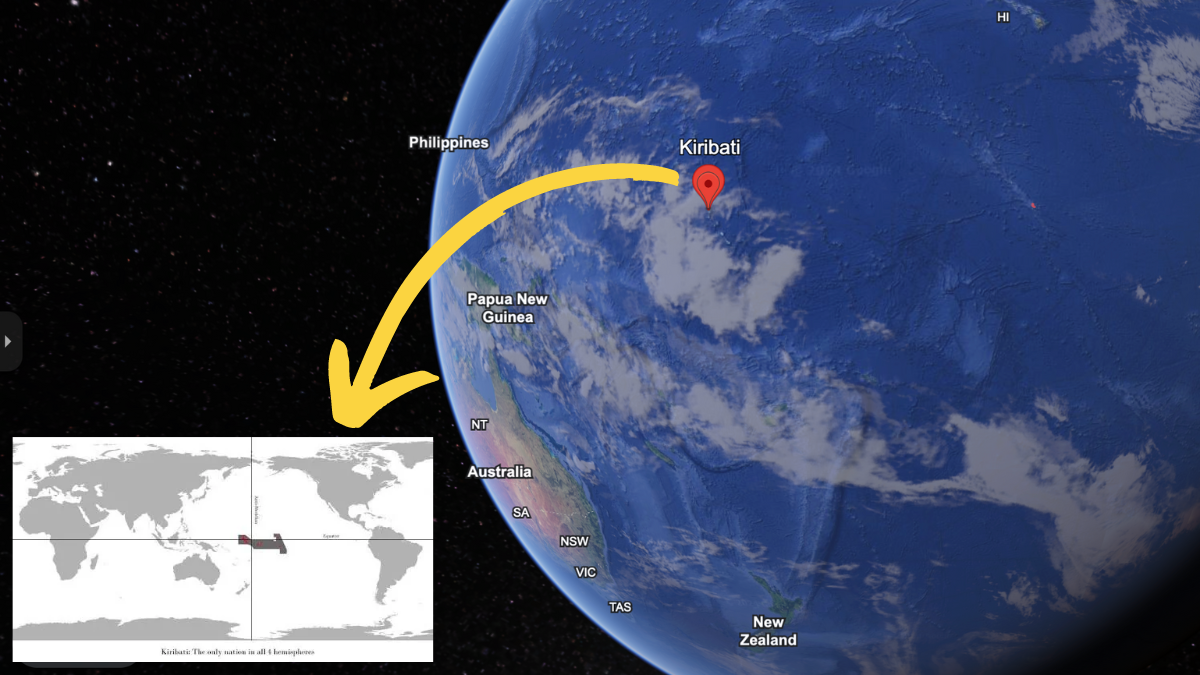
Though Kiribati's landmass encompasses only about 323 square miles, these islands are spread over 1.35 million square miles that straddle the equator and the 180th meridian. It is for this reason that posts on social media since at least 2015 have claimed that it is the only country in all four hemispheres, such as the below post on Reddit shared in 2017:
Kiribati is the only county in the world in all 4 hemispheres [524x280]
byu/C170370 inMapPorn
Hayley Drennon, a senior research assistant at Columbia University's Lamont-Doherty Earth Observatory, confirmed to Snopes that it is true that Kiribati is "technically the only 'country' to do this." Therefore, we have rated this claim as "True."
Below, you can see the intersection of the four hemispheres where the equator (blue horizontal line) crosses the 180th meridian (purple vertical line):
 (CIA)
(CIA)
The globe is generally divided into four parts, or hemispheres, based on each cardinal direction. Horizontally, the equator divides the earth at 0 degrees latitude into the Northern and Southern hemispheres. Vertically, it is divided by two lines: the Prime Meridian at 0 degrees longitude and the 180th meridian, which is the basis for the International Date Line.
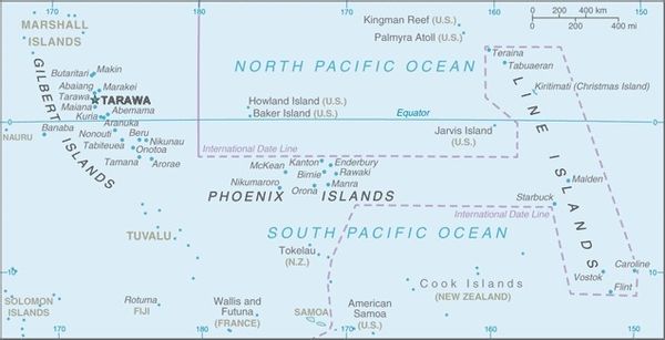
Located in the central Pacific Ocean, Kiribati is made of three distinct island groups: the Gilbert Islands, the Line Islands, and the Phoenix Islands, according to the CIA. Within these three island groups are 32 coral atolls and one coral island straddling the equator and 180th meridian.
Kiribati is the only country whose main landmass stretches across all four hemispheres. However, because of their independently owned territories, France, the United Kingdom and the United States also can make this claim.
Mainland France, for example, is located in the Northern, Western and Eastern hemispheres. Of its territorial communities, La Réunion, Mayotte, New Caledonia, Polynesia, and Wallis and Futuna are located in the Southern Hemisphere.
Similarly, the U.K. is made up of four countries — England, Scotland, Wales, and Northern Ireland — that stretch across the Northern, Western and Eastern hemispheres. Of its 14 overseas territories that have retained a constitutional link with the U.K., according to the Commonwealth Parliamentary Association, several are in the Southern Hemisphere: Ascension, the Falkland Islands, St. Helena and Tristan da Cunha.
Because of Alaska and Hawaii, the U.S. also stretches across the Northern, Western and Eastern hemispheres. When including its territories listed by the U.S. Department of the Interior, the U.S. also technically stretches into the Southern Hemisphere, thanks to American Samoa.