
As Hurricane Hermine approached the eastern coast of the United States in September 2016, a photograph purportedly showing a large waterspout near Avalon Pier in North Carolina started circulating online:
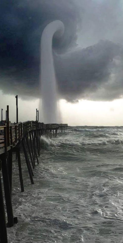
However, this photograph has been digitally manipulated and does not depict a waterspout spotted off the coast of North Carolina. It's a composite that used an image of waterspout in Florida captured in July 2013 by photographer Joey Mole:
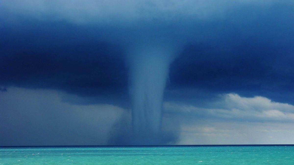
What's happening over the water? Pictured above is one of the better images yet recorded of a waterspout, a type of tornado that occurs over water. Waterspouts are spinning columns of rising moist air that typically form over warm water. Waterspouts can be as dangerous as tornadoes and can feature wind speeds over 200 kilometers per hour. Some waterspouts form away from thunderstorms and even during relatively fair weather. Waterspouts may be relatively transparent and initially visible only by an unusual pattern they create on the water. The above image was taken near Tampa Bay, Florida. The Atlantic Ocean off the coast of Florida is arguably the most active area in the world for waterspouts, with hundreds forming each year. Some people speculate that waterspouts are responsible for some of the losses recorded in the Bermuda Triangle.
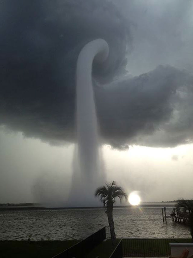
This is at least the second time that Mole's original photograph of a waterspout has been doctored or mislabeled. In October 2015, the same image was circulated along with the claim that it showed Hurricane Patricia making landfall in Mexico.